Nick Bentley
Today
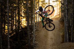
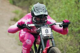
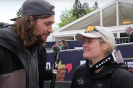
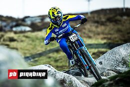
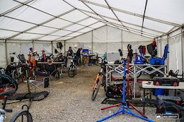 Interviews: Inside the Privateer Pits - Fort William World Cup DH 2024
We hear from the privateers of Fort William about what they thought of the new Privateer Pits along with Ruaridh Cunningham, who is the Director of Gravity Sport at Warner Brothers Discovery.
Sarah Moore
Today
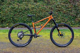
 Frameworks DH Bikes Stolen in Milton Keynes, UK
Asa Vermette, Angel Suarez and Neko Mulally's Frameworks race bikes were stolen from their van in Milton Keynes, UK.
Nick Bentley
Today
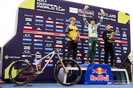
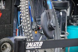
 Interview: Data Acquisition & Developing Future Champions with Nick Lester - Team Manager of the Muc-Off Young Guns
Muc-Off Young Guns rider Heather Wilson took the win at her first ever World Cup.
Matt Beer
Today
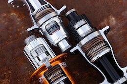
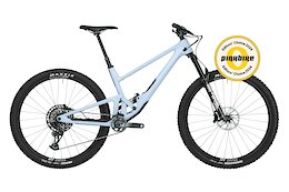
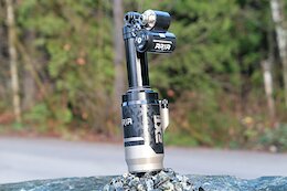 Review: EXT Aria Air Shock
There were a few hiccups, but by the end of testing the Aria delivered excellent mid-stroke support and bottom out resistance.
Kona Bikes
Today
 Video: Whistler Hype Edit with Peter Wojnar & Matt Tongue in 'Lost Property'
Just one week left until Whismas!
Sarah Moore
Today
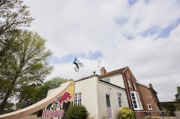 Video: Matt Jones Builds A Huge Ramp & Jumps Over His House
"Even as a kid I dreamed of jumping over a house and now it's time to do it for real."
Nick Bentley
Today
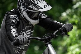
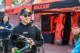 Interview: Adam Brayton on 100 World Cup DH Starts - Fort William World Cup DH 2024
There aren't very many riders out there who have raced in 100 World Cups, and this weekend at Fort William, Adam Brayton joined that elite club.
 Details Announced for Hotlaps MTB Event
Enduro, dual slalom, jump jam, and more.
 Final Randoms: Bike Festival Riva 2024
Outside Online
Today

 Zwift Increases Price for First Time Since 2017
The new rate will go into effect starting today for new customers and at the next pay cycle after June 6 for current customers.
Dario DiGiulio
Today
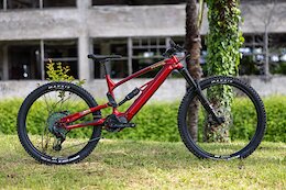
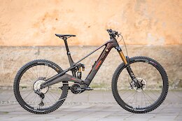 First Look: The Rotwild R.EXC is a Race-Focused eMTB With a 820 Wh Battery
The R.EXC has a 820 Wh battery and uses a Shimano EP801 motor.
Ed Spratt
May 7, 2024
 Must Watch: Wild Scenes in the Sleeper Shreddit from the Fort William DH World Cup 2024
Sleeper are back to start the 2024 season with another incredible race shreddit.
COMMENCAL BIKES & SKIS
Today
 Video: Commencal Shares the Stoke for Opening Day at the Whistler Bike Park
Only a week to go before A-Line laps are back on!
Holly Duncan
Today
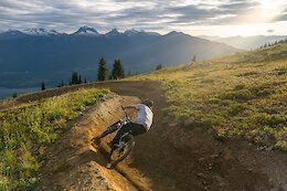
 Trailforks Trail of the Month: Deliverance - Squamish, BC
This old-school steep and deep trail, recently got a new-school makeover.
ECHOS Communications
Today
 Chris King Introduces Generation 4 Hub System
The hubs have a new driver / axle system, and more universal parts.
Sarah Moore
May 6, 2024
 Brett Rheeder Announces He’s Sold Title MTB, Intends to Start New Brand
We look forward to seeing what Rheeder cooks up next.
WeAreOne Composites
May 6, 2024
 Video: We Are One Momentum Project with Mark Wallace & Jon Mozell - Episode 2
The final pre-season test camp before Fort William with the We Are One crew.
Jessie-May Morgan
May 6, 2024
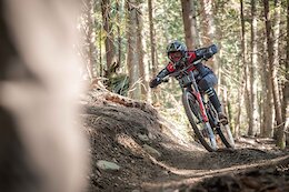
 4 Tech Takeaways From the Fort William DH World Cup
We take a moment to reflect on a track that is faster than ever, and the bikes and technology being deployed to help riders beat the clock.
Dario DiGiulio
May 6, 2024
 Review: Starling MegaMurmur - The Big Bird
With 165mm of rear travel, this British-made beast is meant to handle the fastest and gnarliest terrain around.
TEBP
May 6, 2024
 Day 2 Randoms: Bike Festival Riva 2024
There are some seriously wild designs in this roundup from Riva.
Wyn Masters
May 6, 2024
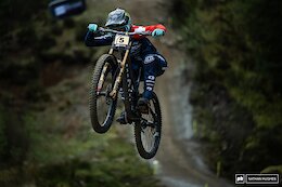
 Video: WynTV Finals Day - Fort William DH World Cup 2024
Wyn hits the pits to catch all the stories after an epic round one of the 2024 DH World Cup at Fort William!
Official Crankworx
May 6, 2024
 Crankworx Cairns Announces Preliminary Rider Lists, Course Updates & More
The Crankworx World Tour heads to Cairns next from May 22-26.
Pinkbike Originals
May 6, 2024
 Video: Spectacular Racing in Fort William - Story Of The Race with Ben Cathro
Enjoy the soothing tones of the wonderful Ben Cathro as we kick off the 2024 season coverage.
Outside Online
May 6, 2024
 Our 5 Favorite Trail Bikes Right Now
Of the 15 trail bikes we tested last year, these impressed us the most.
Mountain Biking BC
May 6, 2024
 Opening Days Announced for 7 of British Columbia's Bike Parks
The summer 2024 season is about to get started.
Ed Spratt
May 6, 2024
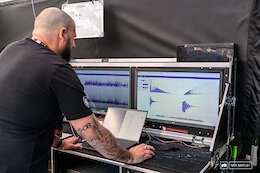
 Elite & Junior Race Analysis from the Fort William DH World Cup 2024
A deep dive into the stats and splits from round one of the 2024 Downhill World Cup series.
Ed Spratt
May 6, 2024
 Finals Photo Epic: Fort William DH World Cup 2024
The legendary Fort William course delivered more racing moments to remember.
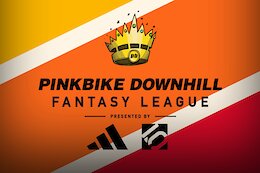
Pinkbike Staff
May 6, 2024
 Fantasy DH League Results: Who Won the First Round - Fort William DH World Cup 2024
The results are in for the first round of Pinkbike's DH Fantasy League, presented by the good people at Five Ten.
RideWrap HQ
May 6, 2024
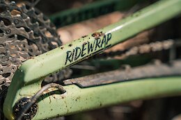 RideWrap Launches Protection Film Made from Recycled Materials
The bicycle-specific protection film is made from 77% recycled materials with embedded superhydrophobic ceramic and self-healing properties.
Ed Spratt
May 6, 2024
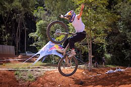
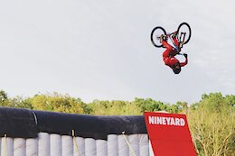 Video: Christian Arehart's World First MTB Quad Flip
A huge new world first from Christian Arehart.
Archive Navigator


2024 Advertiser List
Brands
Bikes
- Trek
- Specialized
- Devinci
- Rocky Mountain
- Giant Bikes
- Scott
- Kona
- Norco
- Commencal
- NS Bikes
- Santa Cruz
- Yeti
- YT Industries
- Polygon Bikes
- Cube
- Radon Bikes
- Marin
- Guerrilla Gravity
- RSD Bikes
- Propain Bikes
- DMR Bikes
- Canyon
- PRIME Bicycles
- Pivot Cycles
- Hybridizer Bikes
Components
- SRAM
- Shimano
- Race Face
- Industry Nine
- SDG
- Deity
- Hunt Wheels
- One Up Components
- KS
- Rotor Bike Components
- Stan’s NoTubes
- Reverse Components
- RideWrap
- PROLOGO
- Yoshimura Cycling
- TRP Cycling
- Galfer USA
- Bikeyoke
- e*thirteen
- Geo Handguards
Suspension
Tires
Accessories
Coaching and Education
Online Retailers
Resorts/Riding
- Trestle Bike Park
- Bike Parks BC
- Fernie
- Crested Butte
- Big White
- Saalbach Hinterglemm
- Whitefish Mountain Resort
- Visit Tucson
- Monument Trails
- Mountain Bike Park City